
Last updated on June 18th, 2026 at 05:04 pm
The South Tufa Trail around the shores of Mono Lake is an easy hike in an unusual setting. Family friendly and educational, it’s a great introductory hike for visitors to the Sierra Nevada region.
I hiked the Mono Lake South Tufa Trail as part of a group hiking trip and, if you’re able, I definitely recommend adding it to your trip itinerary.
In this post I’ll provide a practical guide for hiking the Mono Lake South Tufa Trail. I’ll set out how to get to the trail and what you can expect as you hike along it. I’ll also provide a touch of history so you can better understand this unusual, must see environment.
Mono Lake – What Is Unusual About It?
The following features make Mono Lake and its surrounds an unusual environment:
1. Age
Mono Lake is estimated to be around one million years old making it one of the oldest lakes in North America. It is located in the Mono Basin which lies about 13 miles to the east of the Tioga Pass Entrance into Yosemite National Park.
2. Salinity
The lake has no outlet and is bordered to the west by the Sierra Nevada Mountains. Over time, salts and minerals have washed into the lake from the mountains. Because there is no outlet for the freshwater it evaporates, leaving the salts and minerals behind. As a result, the lake is 2.5 times as salty and 80 times as alkaline as the sea. If you go swimming in the lake, you will float!
As with the Dead Sea, the water in Mono Lake has an oily, slippery feel to it – this is due to the high concentration of salt. Swimmers will need to keep the water out of their eyes and away from skin grazes/cuts….they will sting!

3. Tufa
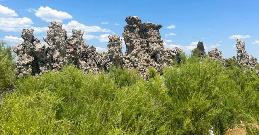
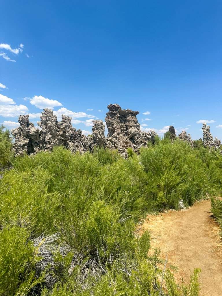
The strange looking structures in and around Lake Mono are called Tufa Towers. Tufa (pronounced “toofah”) are made of calcium carbonate and form when freshwater springs mix with the alkaline water of Mono Lake. Calcium carbonate is the same material forming stalactites and stalagmites found in caves, however tufa can grow at a much quicker rate.
The tufa originally form at the bottom of the lake, however, as you will read below, falling lake levels have meant that the tufa are now visible above the surface of the water.


4. Wildlife and Vegetation
No fish live in the lake, however Mono Lake is home to trillions of brine shrimp and alkali flies. The alkali flies can in fact walk under the water by encasing themselves in air bubbles!
The brine shrimp and alkali flies feed on algae and are themselves a source of food for the millions of migratory birds who come to the lake. In addition, the lake is home to various nesting birds including gulls and Ospreys.
There are 3 common plants at Mono Lake – Rubber Rabbitbrush, Big Sagebrush and Caterpillar Greasewood. There are no tall trees however so the lack of shade makes it hot during summer.

5. The Fight to Save Mono Lake
There has been an ongoing battle to save Mono Lake over the years. Los Angeles authorities began diverting water from its tributary streams in the 1940s with the result that Mono Lake shrank in size but intensified in salinity. The Mono Lake Committee was formed in order to fight for the protection of the lake. Various court cases ensued and eventually it was agreed that the lake would be managed such that its level would be raised to 6,392 feet above sea level (although this is lower than it was in 1941). As at 1st June 2026, the lake was 6,382.9 feet above sea level. Look at for the sign boards indicating this historic levels of the lake as you hike the Mono Lake South Tufa Trail.
You can learn more about the fight to save Mono Lake on the official Mono Lake Committee website.
6. The Creation of the Mono Lake Tufa State Natural Reserve
Established in 1981 to preserve the tufa and other natural features of Mono Lake, the Reserve together with California State Parks manages the lake and public lands around Mono Lake. The area surrounding the lake is protected and was designated the Mono Basin National Forest Scenic Area in 1984.
You can learn more about the Reserve on the official Mono Lake Tufa State Natural Reserve website.
Where is the South Tufa Trail?
Widely regarded as the best place to see tufa, the South Tufa Trail is located at the end of Test Station Road off Highway 120 and close to Highway 395 near the town of Lee Vining. You can see the South Tufa Area on Google Maps – magnify this to see the trail loop. A plan is also attached to the brochure available for download on the official Mono Lake Tufa State Natural Reserve website.
There is a fee payable of $3 per person aged 16 and over. Children 15 and under are free. Interagency Passes are accepted. There is a good sized carpark at the trailhead and 3 vault toilets.
The trail is open 24 hours a day, 7 days a week.
What to Expect on the South Tufa Trail
Hike Details
The trail is a circular trail about 1.4 kilometres (0.8 miles) long. Elevation gain is 9 metres (29.5 feet). The hike is basically a self guided nature trail – check the official Mono Lake Committee website for a great audio recording and written transcript of their self guided tour. I did not have the benefit of this during my hike!
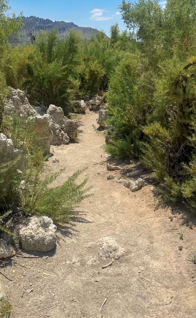
You can choose to hike the trail in a clockwise (as I did) direction or anticlockwise. The trail starts out as asphalt and then, if going clockwise, it will become wooden boards before becoming a mix of sand and dirt. It’s all flat however. There are some wet areas to negotiate but these are small and relatively uneventful.
Hiking time is anywhere from 30 minutes and beyond. Dog are allowed on the trail.

What to Look Out for:
1. Information Kiosk
Just before you get on to the asphalt path at the start of the hike there’s an information kiosk/display unit setting out details about Mono Lake, its history and future. We had the benefit of a short talk from a ranger – take advantage of that if it’s available during your visit.
The display boards themselves are very informative and worth taking time to read. This is also the most shade you’ll get during your visit to the South Tufa Trail!

2. Lake Mono Height Indicators Over The Years
Along the trail you will see height indicators such as the one shown in the photo below. These are a great reminder of where the lake used to be at that point in time. They also provide a very stark indicator as to just how much the lake has shrunk.

3. Information Boards
There are information boards on the trail – take the time to stop and read them.

4. Tufas…of course!
You will be able to get up close to the many tufa now on shore. Those still in the water can be viewed at various points around the shoreline.


5. Sierra Nevada Mountains
If you hike the trail in a clockwise direction, then the Sierra Nevada Mountains are off to your left. There was only a dusting of snow on them when I hiked there in July but I imagine they would look wonderful during the winter months.

The Mono Basin Scenic Area Visitor Center
Unfortunately, we did not have the opportunity to visit the Mono Basin Scenic Area Visitor Center in Lee Vining which is a shame as I have read good things about it. The Center includes exhibits about the natural and human history of Mono Lake, a bookstore, film and art galleries. Based on what I have read, you may want to consider visiting the Centre first before heading to the trail.
Hiking Tips
The South Tufa Trail is a very easy hike but here’s a couple of tips that will hopefully enhance your experience:
- there is no shade when out on the trail so when hiking in the summer do wear a hat and sunscreen and carry water – there is no water available on trail and remember…the lake is salty!
- take binoculars so you can look out for the Ospreys who build nests on the top of some of the tufa
- drone usage is not permitted
- don’t climb on the tufa

Final Thoughts
If you’re looking for an easy hike in an otherworldly environment, then hiking the South Tufa Trail should definitely be on your to do list. During this hike, you’ll not only learn about and see the weird looking tufa towers, but you’ll also witness how human development has impacted the delicate ecology of which they are a part.
The South Tufa Trail is only about 13 miles (21 kms) east of the Tioga Pass Entrance into Yosemite National Park yet it feels a million miles from the mountains, trees and granite that dominate Yosemite.
I hiked the South Tufa Trail after having spent a few days in Yosemite. If you’re planning a trip to Yosemite too, then do read my posts:
- How to Spend 2 Days in Yosemite National Park
- Hiking the Mist Trail to Beautiful Vernal Falls – What to Expect
- Tuolumne Grove of Giant Sequoias – Is the Trail Worth It?
If you are planning to spend time in San Francisco before or after your Yosemite trip, then check out the other posts in my San Francisco series.
Finally, if you need any general assistance with planning a trip to San Francisco and/or Yosemite National Park (or any trips for that matter!), then check out my Resources page.
Happy hiking!

Disclaimer – Information correct at the time of writing but do check before visiting.


Leave a Comment